Snow Forecast Sites: How to Choose and Check Them
There is no single most accurate snow forecast site. The better ones show a range of outcomes instead of one number, adjust for elevation, and say where their data comes from. The most reliable approach is to use two or three tools for different jobs: an official forecast for the big picture, a mountain-specific forecast for the lift-top details, and an authorized webcam to see what is actually falling.
This guide explains what separates a useful snow forecast from a misleading one, which types of sites to use for which question, and how to cross-check a forecast before you book a trip or drive to a trailhead.
Compare forecasts with available webcam views. Check original providers and official weather alerts before making travel decisions. Explore webcams on the map.
TL;DR
- Prefer forecasts that give a range (for example, a low and high snowfall estimate) over a single total. Single numbers hide uncertainty.
- Mountain snow forecasts should be elevation-specific. Base, mid-mountain and summit conditions can differ a lot, including rain at the bottom and snow at the top.
- Seasonal outlooks tell you about odds for a whole winter, not about snow on the day you arrive. Ignore any site that promises exact season totals.
- Use webcams from authorized sources to check what a forecast is doing right now, but never as your only input for road, backcountry or safety decisions.
- For avalanche terrain, read the regional avalanche bulletin first. A snow forecast is not an avalanche forecast.
Table of Contents
- What a good snow forecast actually does
- Which type of site answers which question
- Mountain snow forecast: what changes at altitude
- Seasonal outlooks: what they can and cannot tell you
- Check the forecast against the ground
- Avalanche terrain needs its own forecast
- Using webcams to follow a snowy place
- How to compare two snow forecast sites
- A worked example: planning a December ski weekend
- Frequently asked questions
- Sources
What a good snow forecast actually does
Snow is harder to forecast than rain, and the reasons are useful to know because they tell you what to look for on a site.
Ranges beat single numbers
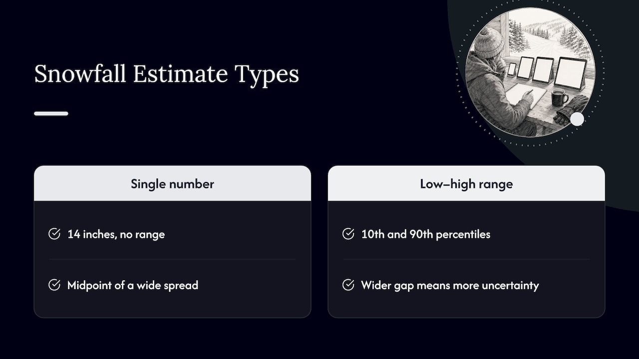
Forecasters at the National Weather Service (NWS) have moved from giving one deterministic number to communicating a range of possibilities. The Weather Prediction Center’s probabilistic winter precipitation products are built around that idea. They use percentile values, such as the 10th and 90th, to show how much uncertainty sits behind a snowfall map.
For you, the practical rule is simple. If a site says “14 inches” with no range, treat it as a midpoint of a wide spread. If it shows something like a low-end and high-end estimate, it is telling you how much to trust the number. A big gap between the two means the storm track or temperature is still uncertain, and plans should stay flexible.
Ensembles and post-processing
Behind the better forecasts are ensembles: many runs of a weather model with slightly different starting conditions. NOAA’s Weather Program Office has described work with the University of Utah on improving prediction of high-impact winter storms using ensemble forecasts and post-processing. You do not need to understand the math. You only need to know that a site which blends several model runs and explains it will usually serve you better than one that quotes a single model.
Snow-to-liquid ratio
Models predict liquid water. Sites convert that to snow depth with a snow-to-liquid ratio (SLR). Many simple tools assume a fixed 10:1 ratio, meaning 1 inch of water becomes 10 inches of snow. Real ratios vary with temperature and moisture: colder, drier air tends to produce fluffier snow and a higher ratio, while warm, wet storms produce heavy snow and a lower one. The WPC documentation on its winter precipitation products describes the use of variable ratios rather than a fixed one. When you compare sites, check whether the methodology page mentions dynamic or elevation-specific ratios. If it says nothing, the totals are probably rougher than they look.
Elevation matters more than the town name
A forecast for a valley town can be wrong for the ski area above it. Look for sites that give separate numbers for the base, the mid-mountain and the top of the lifts. A storm that drops 8 inches up high can bring rain at the base, and the difference decides whether you get powder or slush.
Which type of site answers which question
The sites that rank for this topic fall into a few types. Rather than ranking brands, it helps to match the type to your question.
| Your question | Best type of tool | What to check |
|---|---|---|
| Will it snow at my house or on my road this weekend? | Official national forecast (NWS) | Point forecast, winter weather alerts, hourly temperature |
| Where is the next big storm headed? | Official national forecast plus a mountain-focused forecaster | Percentile ranges, discussion text |
| How much snow at this ski area, top versus bottom? | Resort-level snow forecast and snow report | Elevation bands, update time, who measured the snowfall |
| Is the backcountry safe? | Regional avalanche center bulletin | Danger rating, problems, issue date |
| What does it look like there right now? | Authorized webcam from the original provider | Timestamp, camera elevation, direction of view |
| What will the whole winter be like? | NOAA seasonal outlook | Probability tilts only, no totals |
Official forecasts: the foundation
The NWS point forecast is free, covers the whole US, and is written by forecasters. It also carries watches, warnings and advisories for winter storms. As an example of how location-specific it gets, the NWS page for Index, Washington lists a detailed forecast with day and night temperatures and wind. On October 16, 2026 it showed mostly sunny to clear conditions with highs in the 60s and 70s, so no snow was in the forecast for that town at 486 feet. That is a good reminder that many “is it snowing in…” questions have a boring answer outside winter, and that a forecast is a snapshot dated to the day you read it.
Mountain and ski forecasts
Ski-focused forecast sites add what the national products do not: lift-top forecasts, resort snow reports and trail or lift status. Use them for the detail, and check the update time. A snow report is a morning observation by resort staff, while a forecast is a model product. They answer different questions, and the best sites label them clearly.
When you read ski snow forecasts, ask three things:
- Is the number for the top, middle or bottom of the mountain?
- How far out is it? Confidence drops quickly after about five days, and most useful decisions about a specific storm should wait until it is within a few days.
- Is a range shown? If not, assume the real result could be well above or below.
Forecasters who write about storms
Some sites are run by individual meteorologists or small teams who write daily discussions about storm timing and snow quality. These can be very good for reading the reasoning behind the numbers. Treat them as interpretation layered on public model data, and compare their view with the official forecast when a storm is close.
Mountain snow forecast: what changes at altitude
Mountain weather is local. Terrain pushes air upward, cools it and wrings out precipitation on windward slopes, a process forecasters call orographic precipitation. NOAA’s review of winter storm forecasting advances lists orographic precipitation processes among the topics where field campaigns have improved understanding, alongside snowbands and lake-effect snow. The point for travelers is that coarse regional model output smooths over valleys and ridges, so the two sides of the same range can get very different snow.
Some practical consequences:
- Snow level can swing by thousands of feet within one storm. A forecast that says “snow” without a snow level is incomplete if you are driving over a pass.
- Wind moves snow. A site can report 10 inches of fresh snow while a windy ridge has been scoured and a lee slope has loaded.
- Timing matters as much as totals. Snow that falls overnight and ends by sunrise is a different trip from snow that arrives at noon.
The NWS runs regional pages for mountain areas. The Seattle office, for example, has a mountain observations and forecasts page with snow level forecasts for Washington. Pages like this are a good place to see the official view before you open anything else.
Seasonal outlooks: what they can and cannot tell you
Every autumn, headlines announce what the coming winter will bring. Read them carefully.
NOAA’s Climate Prediction Center issues the official seasonal outlooks. They give probabilities for temperature and precipitation over a three-month period. For example, the NWS has summarized the CPC outlook for December 2026 through February 2027 as probability tilts, not forecasts of specific storms. A tilt toward “warmer than normal” does not mean no snow, and a tilt toward wetter conditions does not promise a powder weekend.
Two habits keep you honest:
- Do not confuse averages with predictions. A regional summary of the Colorado winter outlook notes that Denver’s normal seasonal snowfall is about 49 inches, but that figure is a historical baseline, not a forecast for the coming season.
- Be wary of exact season totals. A seasonal outlook cannot say when a storm will track over a particular resort, so any site promising a definitive total for the winter is claiming more than the science supports.
Use seasonal outlooks for broad planning, such as deciding whether to book flexible lodging, and use short-range forecasts for actual trip dates.
Check the forecast against the ground
A forecast is a prediction. The next step is to compare it with what is happening. This is where webcams help, as long as you know their limits.
What a webcam can confirm
A camera can show you things a number cannot:
- Whether precipitation is falling as snow, rain or a mix.
- Visibility, fog and cloud sitting on the summit.
- Whether roads, parking areas and lifts look clear or covered.
- Rough snow cover at one elevation compared with another, if you can find cameras at base and summit.
That last comparison is the useful one for mountain trips. Our guide to ski resort webcams explains how to check camera elevation and direction so you know what you are looking at before you trust it.
What a webcam cannot tell you
A still image or stream does not show snow depth accurately, wind loading, avalanche danger or how conditions will change in two hours. Cameras also freeze, go dark, get iced over or show an old frame. Always check the timestamp and treat a webcam as one observation at one point, not a verdict on the mountain. Do not use webcam imagery alone to make weather, road, travel or safety decisions.
A quick cross-check routine
- Read the NWS point forecast and any active winter alerts for your route and destination.
- Open a mountain forecast with elevation bands and note the snow level and the range of totals.
- Look at authorized webcams at different elevations, and confirm the timestamp.
- If you plan to leave the groomed terrain, read the avalanche bulletin (see below).
- Check the resort or road authority for operating status the morning you go.
Avalanche terrain needs its own forecast
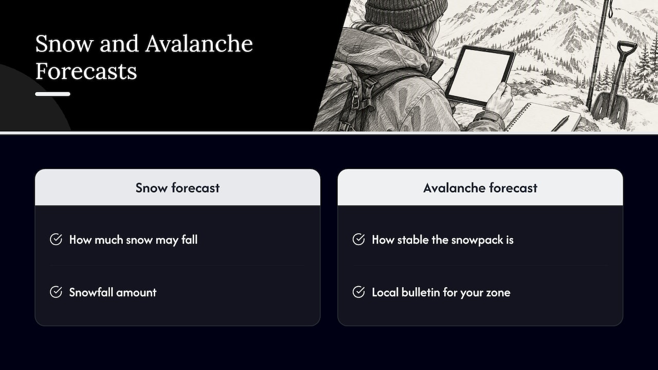
A snow forecast tells you how much snow may fall. An avalanche forecast tells you how stable the snowpack is. They are different products, written by different people. Avalanche.org explains that most North American avalanche centers publish daily forecasts, sometimes called bulletins or advisories, describing snowpack and avalanche conditions. The seasonal calendar varies by center, and the NWS mountain page above notes, for instance, that avalanche center forecasts for Washington are routinely available from mid-November through mid-April.
If you are headed into the backcountry or steep off-piste terrain, read the local avalanche center bulletin for your zone on the day you go, check its issue date, and talk to the nearest avalanche center or ski patrol if anything is unclear. Webcams and snow forecasts do not replace that.
Using webcams to follow a snowy place
Planning around snow is easier when you can watch a location over several days. GlobeWebcams is a directory that organizes public and authorized webcams by country, category and place, and links back to the original providers so you can see who runs each camera. We do not own or operate the cameras, and we apply source-rights, availability and quality checks before publishing a page. You can read how in our methodology and see where views come from on the sources page.
A few ways to use the map for winter planning:
- Mountain states and provinces. Start from the United States webcams or Canada webcams pages and narrow to the region you plan to visit.
- National parks in winter. Our guide to finding national park webcams shows how to search by map. A place such as Rocky Mountain National Park or the Isle Royale listing is a starting point for seeing local sky and ground conditions, once you have checked the park’s official status pages for closures.
- Alpine and northern destinations abroad. The Switzerland webcams page covers the Alps, and traffic cameras such as the Pyhätunturi camera in Finland show how a road authority’s view can add winter context for a fell area. Whether any given camera is currently working depends on its provider, so check the timestamp each time.
To start from the whole world rather than one country, open the GlobeWebcams map and zoom to the range you are interested in.
How to compare two snow forecast sites
When two sources disagree, do not average them in your head. Work through this checklist:
| Check | Good sign | Warning sign |
|---|---|---|
| Uncertainty | Shows a range or probability | One bold number |
| Elevation | Separate base, mid and top forecasts | One figure per town |
| Method | Explains model sources and snow ratio | No methodology page |
| Timing | Shows when snow starts and ends | Daily totals only |
| Updates | States when it was last updated | No timestamp |
| Long range | Describes outlooks as probabilities | Promises exact season totals |
| Safety | Points to avalanche and road authorities | Presents itself as the only source |
If two reputable tools differ by a few inches, that is normal. If they differ on whether it will be rain or snow, the snow level is near your elevation, and that is the moment to wait for the next update and look at a camera.
A worked example: planning a December ski weekend
Say you are choosing between two Colorado weekends in December. Here is how the layers fit together without pretending any of them is a guarantee.
- A month out: read the CPC seasonal outlook for context only. It will not tell you which weekend is better.
- Ten days out: watch the national forecast discussions and any ranges for large storms. Keep lodging flexible if you can.
- Three to five days out: open resort-level forecasts with elevation bands. Compare the low and high end of the range, and note the snow level against the base elevation.
- The day before: check road conditions with the state transportation department, resort operations, and, if you are going off-piste, the avalanche bulletin.
- The morning of: look at authorized cameras at several elevations, confirm the timestamps, and then decide.
At no point does a single site make the decision. The value comes from layering sources, and each layer catches mistakes in the one before.
Frequently asked questions
What is the most accurate snow forecast website?
No single site wins in every place and every storm. Look for ones that use ensemble forecasts, show ranges instead of one total, and break out forecasts by elevation. The NWS point forecast is a strong baseline, and mountain-specific tools add lift-top detail on top of it.
Can a website tell me how much snow a whole winter will bring?
No. NOAA’s seasonal outlooks give probabilities for temperature and precipitation over three months, not snowfall totals or storm tracks. Treat any site that claims exact winter snowfall as speculation, and use the outlook only for broad planning.
Are webcams good enough to check snow conditions?
They are useful for confirming what a forecast says, such as rain versus snow, visibility and whether surfaces look covered. They cannot measure depth or show avalanche danger, and they can be offline or outdated. Use them alongside official forecasts, never alone.
Do I need an avalanche forecast if I only read snow forecasts?
Yes, if you will be in or under avalanche terrain. Snow forecasts predict accumulation, while avalanche center bulletins assess snowpack stability for a specific zone. Read your local bulletin on the day you go, and ask the avalanche center or ski patrol if you are unsure.
Sources
- About WPC’s Probabilistic Winter Precipitation Forecast (PWPF) Products
- Advancing Probabilistic Prediction of High-Impact Winter Storms, NOAA Weather Program Office
- Innovations in Winter Storm Forecasting and Decision Support Services, NOAA Institutional Repository
- National Weather Service forecast for Index, Washington
- Washington Mountain Observations and Forecasts, National Weather Service Seattle
- Winter 2026-27 Outlook, National Weather Service
- Colorado Winter Forecast 2026-27, MyWild
- Avalanche forecast, Avalanche.org
Recommended
Webcam availability and conditions can change without notice. GlobeWebcams does not operate most listed cameras; feeds and imagery remain under the control of their original providers. Do not rely on webcam imagery alone for weather, road, travel or safety decisions.