Fishing Pier Webcams: How to Pick One and Read It Well
A good fishing pier webcam answers one question quickly: what does the water, sky and rail look like at this pier right now? A great one also tells you who runs the camera, when the image was last updated, and where to get the numbers a picture can’t give you, such as tide times, wind and water temperature. This guide explains how to find pier cameras, what separates a useful page from a pretty one, and how to turn a glance at a feed into a smarter plan for the day.
One point first. A webcam shows a moment. It is not a forecast, and it is not a safety check. Use it as a visual check, then confirm with official sources.
GlobeWebcamsCheck Pier Views Before You GoBrowse webcams by location on GlobeWebcams, then visit the original provider for the live feed and current conditions.Explore webcams on the mapTL;DR
- Pier cams are best for context: surf texture, crowd on the rail, light, cloud and fog. Tides, wind and warnings come from instruments and forecasters.
- The best pages pair video with dated conditions, like the Newport Fishing Pier page in Sunny Isles Beach, Florida, which lists tides, wind, UV and advisories.
- Check the timestamp and the operator. A frozen frame or an unlabeled stream tells you nothing about today.
- Underwater pier cams are the least reliable type, because storms, current and murky water affect both equipment and visibility.
- Browse by place on the GlobeWebcams map, then go to the original provider for the live feed.
Table of Contents
- What a fishing pier webcam is good for
- Examples of pier camera pages worth studying
- What to check before you trust a pier cam
- Pair the picture with real data
- Why a webcam can’t judge rip currents or surf safety
- Blind spots and data gaps
- Underwater pier cams: fun, but the least dependable
- How to find pier webcams by place
- Choosing the right pier cam for your goal
- Sources and rights: why attribution matters
- FAQ
- Sources
What a fishing pier webcam is good for
Piers stick out past the surf line, so a camera mounted on one gives a view that a beach camera can’t: the break from the side, the water color near the pilings, and how many people are fishing at the rail. For an angler or a trip planner, that adds up to a few practical uses.
- Sky and visibility. Fog, haze, rain bands and glare are obvious on camera long before you drive over.
- Water texture. Whitecaps, chop and a flat calm look different. You get a feel for the day, even if you can’t read exact wave height.
- Activity on the pier. Some operators say outright that the camera lets you see how anglers are faring. The Nags Head Pier on the Outer Banks describes its camera that way, alongside a realtime weather station.
- Trip planning. If you’re choosing between two coastal towns for a weekend, a quick look at each pier can settle a lot.
What it is not good for: judging rip currents, deciding whether it is safe to swim or wade, or deciding whether a storm is close. More on that below.
Examples of pier camera pages worth studying
The following operators show what good looks like. We’re not endorsing fishing results or current availability. Each camera can be offline on any given day, so open the page and check the timestamp yourself.
| Pier page | Where | What the page adds to the video |
|---|---|---|
| Newport Fishing Pier beach cam | Sunny Isles Beach, FL | North and south views, plus daily beach conditions, flags, temperatures, tides, wind, UV and advisories. Run by the city. |
| Bonner Bridge Pier webcam | Oregon Inlet, Hatteras Island, NC | National Park Service camera meant to let anglers check conditions, with sunrise, sunset and ocean views. |
| UTMSI research pier cameras | Port Aransas, TX | Two cameras linked to water, weather and buoy observations from the University of Texas Marine Science Institute. |
| Nags Head Pier cam | Outer Banks, NC | Pier-run camera with a live weather station on the same page. |
| Avalon Pier PierCam | Kill Devil Hills, NC | Pier-run camera from a pier that lists its daily opening time. |
Notice the pattern. The strongest pages are run by an identifiable owner: a city, a park service, a university or the pier itself. That makes it easy to judge whether the feed is maintained.
What to check before you trust a pier cam
Run through these five checks. They take under a minute.
- Who runs it? A pier operator, municipality, park agency or research institution is a good sign. An anonymous embed on an aggregator page with no named source is not.
- Is the image moving or timestamped? If the clock burned into the frame is hours old, or the waves look identical on two refreshes, treat the feed as down.
- Which way does it point? North, south, down the rail or out to sea? A south view won’t show a sandbar on the north side. Some pages, like the Sunny Isles Beach one, give you both directions.
- Does the page include dated conditions? Look for tide times, wind, air and water temperature. Dated data beats a video that might be a recording.
- Is it day or night? Many pier cameras are nearly useless after dark, and sunrise glare can wash out the frame.
Our coastal webcams guide goes deeper on verifying source and timestamp, and our harbor webcams guide applies the same checks to working waterfronts.
Pair the picture with real data
A camera shows context. Sensors and forecasters supply measurements. The City of Santa Cruz is a good model: its surf cam page puts live video next to NOAA WaveWatch, the National Weather Service marine forecast, buoy summaries, satellite wind information, tides and local weather. The video is a quick visual check, not the only input.
For your own trip, build a similar routine:
- Marine forecast. Read the National Weather Service marine and surf-zone forecast for your stretch of coast.
- Tide times. Fishing and wading conditions change with the tide. Look up the nearest tide station rather than guessing from the picture.
- Wind and buoys. A nearby buoy reports wind and wave data a camera can’t measure.
- Local tide and access details. Beach and shore access vary by place, and a local guide such as this Palos Verdes tide pool guide shows the kind of detail worth gathering, from best tide windows to parking costs, before you head to the water.
- Pier hours and rules. Many piers charge a fishing fee and close in rough weather. Check the operator’s own page or call.
- Lifeguards. The Sunny Isles Beach page tells visitors to consult lifeguards when conditions are uncertain. That advice applies everywhere lifeguards are on duty.
An example routine for a Saturday morning
Suppose you’re considering a pier on the Outer Banks. The night before, read the marine forecast and note the tide times. In the morning, open the pier’s own camera and look for fog, whitecaps and how many people are on the rail. Then check the pier’s page for hours. If the camera is frozen, ignore it and rely on the forecast and a phone call. Nothing about the picture replaces the forecast; it only confirms or questions it.
Why a webcam can’t judge rip currents or surf safety
It’s tempting to read hazards off a screen. Researchers can use cameras for that, but under controlled conditions. NOAA-linked work shows that time-averaged shoreline imagery can help identify rip currents and validate forecasts. That relies on time series and analysis, not on one frame, so a casual viewer can’t reliably spot a rip current from a still image or a short glance at a stream.
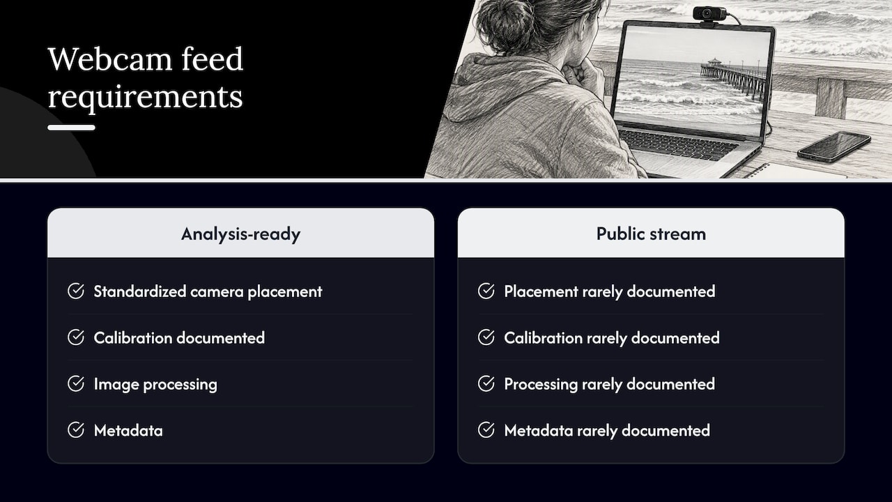
The same caution applies to measurements. NOAA’s WebCAT project describes webcams as useful for surf observation, beach safety, shoreline change and wave runup. It also stresses that standardized placement, calibration, image processing and metadata are what make footage usable for those purposes. An ordinary public pier stream rarely documents any of that, so treat it as visual context unless the operator says otherwise.
In practice: if the swell looks big, the water looks churned, or the weather looks like it’s turning, don’t use the camera to talk yourself into going. Check the forecast, talk to the lifeguard or pier staff, and decide from there.
Blind spots and data gaps
Fixed cameras fail in ordinary ways. Research on coastal video monitoring in New Zealand notes that cameras or housings can be damaged, creating gaps in collection, and that interpreting a shoreline may need lens-distortion correction. You don’t need to correct lens distortion to plan a fishing trip, but the point is useful: the picture on your screen has limits.
- A wide-angle lens makes distant water look calmer and smaller.
- Salt spray and rain on the housing blur the image.
- Pier cameras get taken down for storms and repairs, and sometimes for the season.
- A single angle misses what is happening a few hundred yards along the beach.
Underwater pier cams: fun, but the least dependable
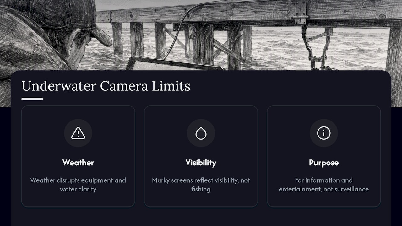
Some piers carry underwater cameras, and they can be fascinating for fish and marine life. They are also the type most affected by weather. Wind, current, storms, rain and wave action all disturb the equipment and the water clarity. The City of Deerfield Beach, Florida, presents its livestreams on a Livestream Cameras page that includes the pier view and an underwater stream, intended for information and entertainment rather than as a substitute for official conditions or surveillance.
A murky screen usually says more about visibility than about fishing. If you’re curious about how these feeds work and how to confirm that one is current, read our guide to live underwater webcams. If marine wildlife is what you’re after, our sea otter cam guide shows the same verification approach for another kind of feed.
How to find pier webcams by place
Searching for a single pier name works when you already know the pier. If you don’t, search the way the National Park Service page is written: by pier name and by activity. Terms such as the pier, the inlet and the word anglers narrow things quickly.
A map is often faster. Pick a coast, zoom in, and see which cameras are nearby. This also helps you compare, for example, two piers 30 miles apart when you’re deciding where to base a weekend.
Browsing on GlobeWebcams
GlobeWebcams is a map-first directory of public or authorized webcams. We don’t own or operate any of the cameras. Each page links back to the original provider, and we apply source-rights, availability and quality checks before publishing a page. Start with the United States webcams hub, or open the worldwide webcam map and zoom to the coast you’re planning for. For a coastal example of how we present a source, see the Marconi Beach camera near Wellfleet. If you’re also checking waves, our guide to live surf webcams explains how to verify the camera and buoy together. You can read how we vet pages on the methodology and sources pages.
Whether a particular camera is working today is something only the provider’s page can confirm. Look at the timestamp there.
Choosing the right pier cam for your goal
| Your goal | What to look for | What to add |
|---|---|---|
| Is it worth the drive for fishing? | A pier-run camera showing the rail and water color | Tide times, marine forecast, pier hours |
| Checking surf before a session | A camera angled along the break | Buoy data, surf forecast |
| Planning a beach day | Beach-facing views, flags and advisories | Lifeguard guidance, UV and temperature |
| Sunrise or sunset | A camera facing east or west with clear timestamps | Sunrise and sunset times |
| Curious about marine life | An underwater cam from a named operator | Patience; expect gaps |
Sources and rights: why attribution matters
Not every publicly accessible stream is meant to be reused. A pier operator pays for a camera, hosts the stream and often wants visitors to land on its own page, which is also where you’ll find hours, fees and announcements. That is why we link back to the original provider rather than reposting video. If you’re building a trip plan, use the provider’s page as the primary view.
FAQ
Are fishing pier webcams really live?
Often, but not always. Cameras go offline for weather, maintenance or seasonal closures, and some pages show delayed or looped images. Check the timestamp, look for motion, and confirm on the provider’s page before relying on what you see.
Can I use a pier cam to decide whether it’s safe to swim or fish?
No. A single view can’t show rip currents, changing tides or approaching weather. Use the National Weather Service marine and surf-zone forecast, tide data and local lifeguards or pier staff for safety decisions, and treat the camera as one visual input.
What should a good pier webcam page include?
An identified operator, a visible timestamp, the direction of the view, and dated conditions such as tide times, wind, temperatures and advisories. The Sunny Isles Beach page for the Newport Fishing Pier is a good example of video and conditions presented separately.
Are underwater pier cams reliable?
They are the most intermittent type. Storms, currents and wave action affect both the equipment and the water clarity, so a dark or cloudy image doesn’t mean much. Treat them as entertainment, as cities such as Deerfield Beach do.
How do I find pier cameras near a destination?
Use a map. On GlobeWebcams you can open the U.S. page or the world map, zoom to the coast, and follow the link to the original provider for the live view.
Sources
- Webcam: Bonner Bridge Pier (U.S. National Park Service)
- Beach Cam and Conditions, Sunny Isles Beach, FL
- Currents & Weather, UT Marine Science Institute
- Surf Cam, Tides & Weather, City of Santa Cruz, CA
- NOAA Launches a New Life-Saving Rip Current Model, SECOORA
- WebCAT: Web Camera Coastal Observing Network, NOAA
- CAM-ERA video beach monitoring, Waikato Coastal Database
- Livestream Cameras, Deerfield Beach, FL
- PierCam, Avalon Pier
Recommended
- 5 Quick Checks Boaters Use to Trust Marina
- Live Surf Webcams: Verify the Camera, Buoy and
- Harbor Webcams: How to Check Whether a Feed Is
- Island Webcams: Four Common Types and How to
Webcam availability and conditions can change without notice. GlobeWebcams does not operate most listed cameras; feeds and imagery remain under the control of their original providers. Do not rely on webcam imagery alone for weather, road, travel or safety decisions.