Boat Ramp Webcams: How to Find and Read Them
A boat ramp webcam is a fixed camera pointed at a launch ramp, its docks or its parking area. It lets you see how busy the ramp is, how the water looks and what the weather is doing before you hitch up the trailer. The best ones are run by park services, port districts and marine agencies, and they work as a quick look, not a final answer. This guide explains what ramp cameras show, where to find them, how to tell a current image from a stale one, and when to put the screen down and check an official source.
GlobeWebcamsCheck Waterfront Views Before You GoBrowse webcam views by place, country or category, and use each page’s link to check the original provider.Explore webcams on the mapTL;DR
- Ramp webcams are most useful for three things: how crowded the ramp and lot are, the general look of the water and sky, and whether docks and ramp surfaces are visible.
- Many are still images that refresh every few minutes, not continuous video. Check the timestamp and compare the scene against the light outside.
- Official operators (national parks, port districts, state marine agencies) are the most reliable hosts. Look for a clear owner and a stated update interval.
- A webcam supports situational awareness only. Use forecasts, tide and water-level data and local advice for any decision about launching.
- On GlobeWebcams you can browse by country, category and place, and each page links back to the original provider.
Table of Contents
- What a boat ramp webcam actually shows
- Where to find boat ramp webcams
- How to tell whether a ramp webcam is current
- What the camera can and cannot tell you
- How to use a ramp webcam in a launch-day routine
- Beyond the ramp: related webcam views
- Find ramp and waterfront views on GlobeWebcams
- What makes a ramp camera worth bookmarking
- FAQ
- Sources
What a boat ramp webcam actually shows
Ramp cameras are usually mounted on a pole, dock house or building and aimed at the slope where trailers back in. The framing differs a lot from site to site, so the first thing to learn is what each camera is built to show.
The National Park Service’s webcam for the Stateline Auxiliary Launch Ramp at Lake Powell is a good example. According to the NPS, the image updates every 10 minutes and takes in the gravel parking area above the ramp, courtesy docks, a breakwater and Navajo Mountain across the lake. The same page notes that the ramp is open for launching when Lake Powell is above 3520 feet. So the view tells you about the surroundings, while the rule about water level comes from the written notice next to it.
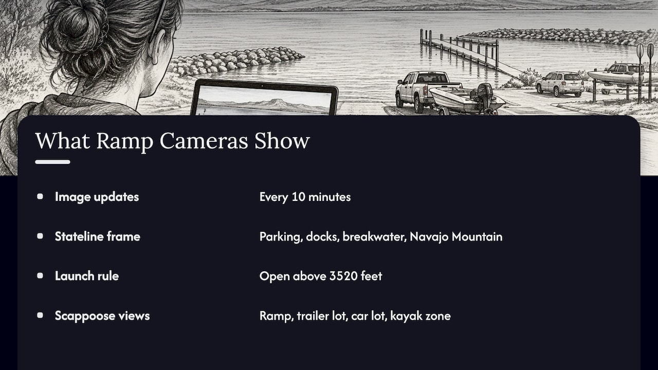
A second example comes from Oregon. The Port of Columbia County runs live marina cameras at Scappoose Bay Marine Park. Its views cover the boat ramp, trailer parking lot, car parking lot and kayak loading zone, so viewers can watch boats come and go on the launch and see water levels. That is a typical set of angles for a busy public ramp: each one answers a separate practical question.
The views you will run into
- Ramp-face view. Shows the slope, the waterline and any boats being launched or retrieved. Best for judging how the water meets the concrete.
- Parking-lot view. Shows how many trucks and trailers are waiting. Best for gauging a busy weekend morning.
- Dock or marina view. Shows courtesy docks and moored boats. Useful for seeing wind on the water through how boats sit and how flags hang.
- Wide scenic view. Shows the lake, bay or mountains. Good for cloud cover and visibility, weak for ramp detail.
- Channel or entrance view. Shows the water leading out to open water. Helpful for a general look at the surface, though it is not a measurement of anything.
Where to find boat ramp webcams
Start with the organization that manages the ramp, then use a directory to widen the search.
Park and land-management agencies
When a ramp sits inside a national recreation area, the managing agency often publishes the camera. The NPS Glen Canyon webcams page is a model. It lists the Wahweap Main Launch Ramp view with images updating every 10 minutes, and it states that the ramp is open for launching vessels when Lake Powell’s elevation is above 3550 feet. It also says a few webcams are not operational and have been removed from the list with no estimated return date. A page that tells you what is offline is a good sign: it means somebody maintains the list.
Ports, harbor districts and municipalities
Local port and utility districts frequently put cameras on their own marinas, as the Scappoose Bay example above shows. These pages usually name the location and the operator, which makes it easy to confirm what you are looking at. Search the name of the ramp together with the words “port”, “parks and recreation” or “harbor” and look for the .gov or district page.
State and national marine agencies
Some agencies treat ramp cameras as a boating service. In Australia, Marine Safety South Australia offers live views at many coastal locations across metropolitan Adelaide, the Fleurieu, Yorke and Eyre peninsulas, the Upper Spencer Gulf and the River Murray. Some show the boat ramp, gulf waters, breakwater or channel, and a few are provided by other councils. In Victoria, the recreational fishing body VRFish explains that Boating Vic takes a photo feed from ramp cameras around the state. These cameras are motion-sensed to show whether a ramp is busy or quiet, and the site also offers Bureau of Meteorology weather and safety alerts for selected ramps.
The lesson for US readers: look for your own state’s boating or natural resources agency, since some of them pair cameras with alerts and conditions pages.
Webcam directories
If you do not know who runs the camera, a directory helps you browse by place. On GlobeWebcams you can start from the worldwide webcam map, open the United States webcam pages or work through the public webcam directory. Each webcam page links to the original provider, so you can confirm who operates the camera and visit the source directly. We do not own or operate these cameras; we organize public and authorized views and credit where they come from. You can read how we handle providers on our sources page.
Because many ramps are lakeside or coastal, our guides to coastal webcams and marina webcams cover related views and the same verification habits.
How to tell whether a ramp webcam is current
A picture of a quiet ramp is only helpful if it is a picture of the ramp right now. Sources vary on how they publish this, so use a few simple checks together. None of them is a guarantee.
- Find the stated update interval. Official pages often say it outright, like the 10-minute refresh on the NPS Lake Powell and Wahweap views. If a page gives no interval at all, treat the view with more caution.
- Read the on-image timestamp. Many cameras burn a date and time into the frame. Compare it to your own clock, keeping the camera’s time zone in mind.
- Match the light. Bright sun in the image while it is dark where the ramp is means the image is old or the feed is frozen. Does the sky look like the weather in your forecast?
- Watch for movement. Reload the page and check that something changed: a boat, a vehicle, waves, shadows. In a still-image camera, two reloads a few minutes apart should differ.
- Check the camera is aimed at the ramp. Cameras get bumped, repointed or covered by lens spray. If the frame shows only sky, a dock or a blur, you are not seeing the launch.
- Confirm the operator. The page should say who runs the camera. Official or clearly identified hosts are easier to trust, and you can contact them when something looks wrong.
- Look for an offline notice. Agencies sometimes post that a camera is down. The NPS page quoted above does this for its cameras that are not working.
On GlobeWebcams, we run availability and quality checks before publishing a webcam page, and we only describe a view as live or current where current source evidence supports it. Even so, the provider’s own page is the final word on its feed, so use the link to the original provider when something looks off.
A quick check table
| What you see | What it may mean | What to do |
|---|---|---|
| Timestamp matches your clock | Image is likely recent | Still confirm with a forecast |
| Timestamp hours or days old | Feed stalled or cached | Reload, then visit the provider page |
| Daylight in the image, dark outside | Old image or wrong time zone | Do not use it for decisions |
| Same frame after several reloads | Frozen or slow-refresh feed | Check the stated update interval |
| Lens fogged, wet or blocked | Weather or dirt on the glass | Use another source for conditions |
| Ramp not in the frame | Camera moved or different view | Read the page description |
What the camera can and cannot tell you
A ramp camera is excellent at some things and blind to others.
What it does well
- Shows whether the lot is full, so you can decide when to arrive.
- Gives a rough sense of whether anyone is launching or retrieving.
- Shows visible weather: rain, fog, snow on the ramp, glare, cloud cover.
- Shows whether docks are in place and the ramp looks clear of debris.
- Shows general water appearance, such as chop, ripples or calm.
What it cannot do
- Measure water depth at the end of the ramp, current speed or wind gusts.
- Show conditions beyond the frame, including the open water you will cross.
- Tell you about closures, hazards or rules posted by the managing agency.
- Replace a forecast, tide table or marine warning.
Official operators say this plainly. Transport for NSW’s Coffs Harbour boat ramp webcam gives live vision of the entrance and ramp with weather updates. Its page says the camera supports general situational awareness only and should not be the sole source of information, because coastal bar conditions can change rapidly. It advises boaters to use multiple sources, including weather forecasts, tides and local advice. The agency’s Tweed Heads coastal bar webcam carries the same message, along with a disclaimer that it does not accept responsibility for errors or omissions or for loss or damage caused by relying on the information.
Those are Australian pages, but the logic carries to any US ramp: a camera is one input among several. At GlobeWebcams we ask the same of our readers. Do not rely on webcam imagery alone for weather, road, travel or safety decisions.
Water level matters more than the picture
On reservoirs, the number can matter more than the image. The NPS pages for Lake Powell tie ramp use to specific lake elevations: above 3520 feet for the Stateline Auxiliary Launch Ramp and above 3550 feet for the Wahweap Main Launch Ramp. A camera might show a ramp that looks fine while the posted threshold says otherwise. Where a ramp has a stated rule, follow the managing agency’s current notice, and use the camera as supporting context only.
Why weather and lens quality affect what you see
Outdoor cameras live in spray, rain, dust and cold, and the image quality shows it. If you want to understand why some outdoor imagery stays sharp in bad weather while other frames go soft, a primer on weather sealed camera bodies explains how sealing protects equipment in wet conditions. For a viewer, the practical takeaway is simple: a smeared or dim frame in rain often reflects the glass or the weather, not the ramp.
How to use a ramp webcam in a launch-day routine
Here is a routine that makes good use of a ramp camera without leaning on it too hard.
- The night before: read the managing agency’s page for the ramp. Look for closures, water-level thresholds, fees, hours and any alerts.
- Check the forecast for the area: use an official weather service for wind, precipitation and any marine or small-craft advisories that apply.
- Morning of: open the ramp camera. Check the timestamp, the parking lot and the ramp surface.
- Compare: does the picture match what the forecast and agency notice say? If they conflict, trust the official notice and call the local office or marina.
- At the ramp: look at the water yourself before you launch. You are the one who can see the whole picture.
If you boat in several places, bookmark each ramp’s official page and its camera together. For lake and bay trips, we suggest also looking at marina views nearby, since they often show wind effects across the water. Our marina webcam checklist walks through the same trust checks from a boater’s view.
Beyond the ramp: related webcam views
A ramp camera is one piece of the picture for a day on the water.
- Coastal views show the shoreline, harbor entrances and sea state. See our guide to coastal webcams for checking the source and timestamp.
- Surf cameras matter if your launch faces open water. Our surf webcam guide covers how to verify the camera and nearby buoy data.
- Underwater cameras are a different kind of view. Our underwater webcam guide explains sources and schedules.
- Yacht club and harbor views in Europe offer a feel for lake conditions, such as the Yachtclub Hard view to the north, to the east and to the south. These come through the Foto-Webcam.eu source and show how a single site can use several angles.
Find ramp and waterfront views on GlobeWebcams
If you are planning a trip and want to look at a lake, harbor or coastline before you go, start with the United States webcam pages or open the interactive world map and zoom to the water you plan to visit. Each page credits the original provider and links to it, so you can go straight to the operator’s own page for the latest image, notices and conditions. We review sources for rights, availability and quality before publishing, and we are a directory, not the operator of any camera.
What makes a ramp camera worth bookmarking
When you compare cameras for a place you visit often, look at these traits.
| Trait | Why it helps |
|---|---|
| Named operator (park, port, agency) | You know who to contact and who maintains it |
| Stated update interval | You know how old the image can be |
| Visible timestamp | You can check freshness in seconds |
| Views of ramp and lot | You get both water and crowd information |
| Notes on offline cameras | Shows the page is kept up |
| Links to weather and alerts | Lets you cross-check in one place |
Victoria’s Boating Vic site, as described by VRFish, shows how far this can go: ramp photos, motion-based busyness indicators, weather and safety alerts together. US ramps are more fragmented, so you will often assemble this yourself from the agency page, a camera and a forecast.
FAQ
Are boat ramp webcams live video or still images?
Both exist. Some pages show video, while others refresh a still image on a timer. The NPS Lake Powell ramp cameras, for example, update every 10 minutes. Read the page for the stated interval and check the timestamp.
Can I use a webcam to decide whether it is safe to launch?
No. A webcam gives a partial, point-in-time view. Agencies that run ramp and bar cameras, such as Transport for NSW, say their cameras provide general situational awareness only. Use official forecasts, water-level or tide information, posted notices and local advice, and look at the water in person.
How do I find the webcam for a specific ramp?
Search the ramp name with the agency or port that manages it, then look for a webcams or conditions page. You can also browse by country and place on GlobeWebcams, and follow the link on each page to the original provider.
Why does the camera show an empty ramp when the lot is full, or the reverse?
The views may be taken at different times, or the camera may refresh slowly. Parking and ramp cameras can also be separate feeds. Check each timestamp and the update interval on the provider’s page.
Sources
- Webcam, Stateline Auxiliary Launch Ramp (U.S. National Park Service)
- Webcams, Glen Canyon National Recreation Area (U.S. National Park Service)
- Live Marina Cameras, Port of Columbia County, OR
- Web cameras, Marine Safety South Australia
- Boat Ramp Cams, VRFish
- Coffs Harbour webcams, NSW Government
- Tweed Heads coastal bar webcam, NSW Government
- Weather sealed camera bodies for outdoor photographers, PhotoView.io
Recommended
- Fishing Pier Webcams: How to Pick One and Read
- 5 Quick Checks Boaters Use to Trust Marina
- River Webcams Live: How to Find Views Worth
- Cruise Port Webcams: Official Views and Five
Webcam availability and conditions can change without notice. GlobeWebcams does not operate most listed cameras; feeds and imagery remain under the control of their original providers. Do not rely on webcam imagery alone for weather, road, travel or safety decisions.